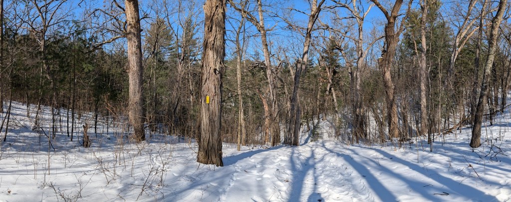
After hiking the southern half of the Scuppernong Segment yesterday, I went back today to walk the northern half. Conditions were much the same today as they were on Tuesday: Sunny, clear skies, a light breeze, temperatures in the twenties. Perfect, except for the temperatures. I dressed for cold weather, packed a lunch, and hit the road at ten-thirty, arriving at the trailhead at about eleven-thirty.
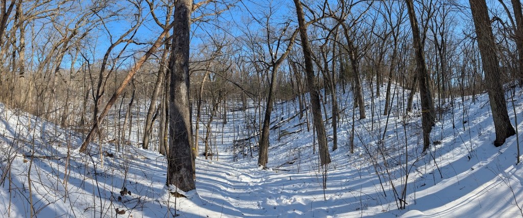
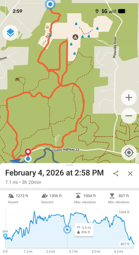
After tramping through the deep shadowy cold of a towering pine forest, the trail dropped into a deep groove between two long, high hills. This was probably the prettiest section of trail I walked today. The way they routed the trail, it wanders in and out of the narrow valleys between long slender eskers, climbing over them occasionally to get to the next valley. My hike through these hills left a graph on my phone app that went up and down repeatedly, leaving a trace that looked like an accordion bellows.
I wish I could have enjoyed the silence more than I did. When I was deep in a valley between hills and the wind was barely blowing, I had the feeling that it was unusually quiet but I couldn’t fully appreciate it over the high-pitched squeal I hear almost constantly these days. When it’s very still, the way it was today, I also hear what sounds like thousands of birds screeching not far away. Tinnitus really yuks my yum and makes me wish I had taken better care to protect my hearing when I was young.
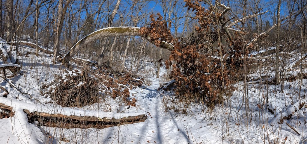
About a mile and a half into my walk, I came to a part of the forest where much of the wood to the east of the trail had been knocked down. The trees alongside the trail were okay, but about fifty to a hundred feet into the forest I could see trunks knocked this way and that, lying across each other in a wreckage of branches. They hadn’t been cut down. All the fallen trees I could see were broken off within ten feet of the roots, as if a massive and irresistible hand had negligently swept over them. The damage appeared to go on quite a ways into the distance. After I got home, I searched the news for stories about a recent storm but didn’t find any likely explanations.
The end of the Scuppernog Segment passed through a white pine forest planted in 1993, according to a sign alongside the trail. The trees were maybe thirty feet tall and a little thicker than my torso. I always feel it’s a treat to get outdoors to experience nature, but I’m never out of eyeshot of reminders like this which tell me I’m always in an entirely human-made environment. As unspoiled and natural as forested lands like these sometimes seem, nothing around me grew up the way it would naturally have done. White pines do not stand in orderly ranks, boulders do not line up along the lot line of their own volition. It’s a bit of a disconnect.
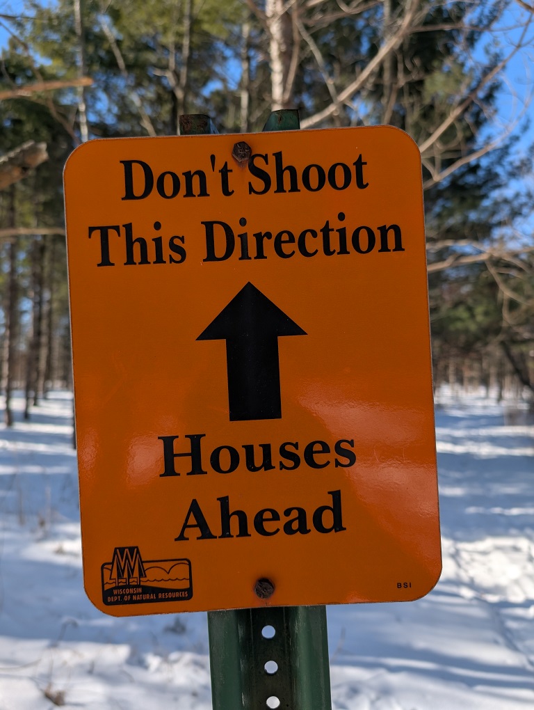
Another sign not far away beseeched me not to shoot in the direction of the houses hidden behind the trees in the distance. When they put up signs like that, it’s usually because somebody’s window got shot out.
I often carry my phone with me when I go hiking. I have a pretty good app I can use to keep track of where I am on the trail, and I can use it to take photos of the “you are here” maps posted at the trail side to help me along, not that doing either of those things keeps me from making wrong turns. I made two wrong turns today which took me at least a mile out of my way. They were so obviously wrong, but only when I was so far down the trail that it didn’t matter whether I turned back or went on.
After walking the Scuppernong Segment almost all the way to the end (I didn’t walk the last bit along the edge of a corn field because it looked pretty boring; and also, I was getting tired), I doubled back until I reached the point where the Ice Age Trail intersected with a ski trail. This was my first wrong turn of the day; turned left when I should have turned right. I meant to take the ski trail back to the parking lot but ended up walking north into a pine forest and didn’t realize my mistake until the trail petered out into an open field.
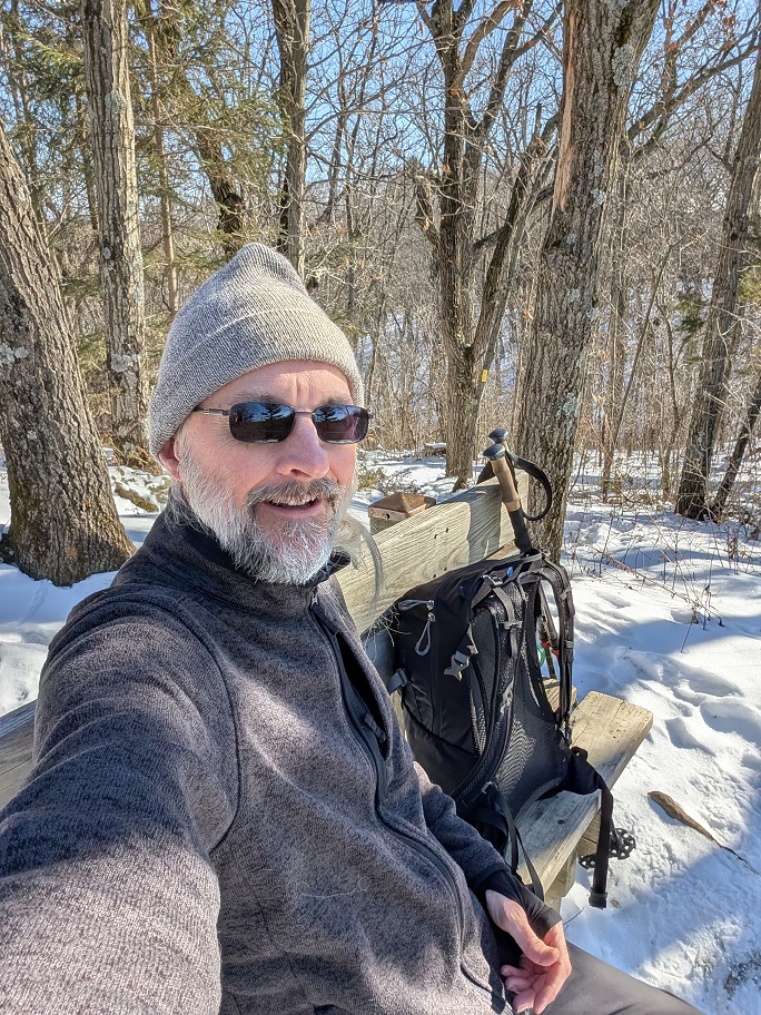
Doubling back, I followed the ski trail until I climbed to a bench at the top of a hill where I could take a ten-minute breather. The trees on the hilltop were sparsely planted and leafless, so I sat in full-strength sunshine, which kept me warm. Well, warmish. I probably couldn’t have sat still like that for more than ten or fifteen minutes without getting uncomfortably cold. After a snack and a few gulps of water I felt much better and ready to finish the hike, but when I got up and hit the trail, I made my second wrong turn. I still don’t know how I did that. The correct turn was so obvious, and still I went the wrong way.
But it didn’t add much to the hike to keep going, so on I went. These ski trails were wide and well-maintained but honestly kind of boring when compared to the IAT. They ran in long straight lines and didn’t go out of their way up or down hills, and I can understand why they might not want to do much of that to people who are on skis. It’s not a negative criticism so much as an observation. I much preferred the IAT.


Leave a comment