The only explanation I can come up with for going out to hike seven miles through the snow in sub-freezing weather today is this: It had been so effing cold for so long that 18 degrees F seemed like a pretty reasonable temperature to hike in, actually. No, really, it did. I stayed inside for so many days while the temps were sub-zero that I got more desperate than I have ever been to get out as each day went by. When temps finally climbed back up into double digits, I dressed up in layers and put on a parka just so I could walk to the library.
Today was another one of those double-digit days, barely. It was ten when I got out of bed, but it was forecasted to get all the way up to 22 deg F. I would’ve kicked myself all day if I didn’t take advantage of that, but I didn’t want to go to the library again. I wanted to go somewhere new.
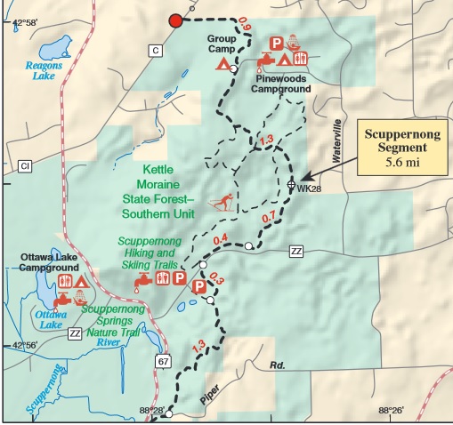
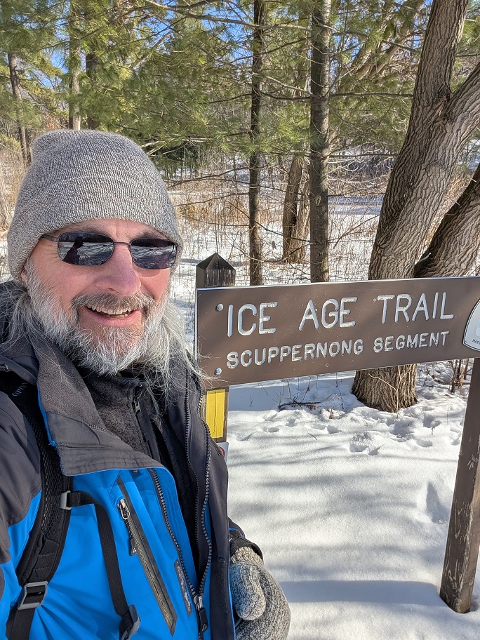
I’ve been slowly chipping away at segments of the Ice Age Trail where it runs through the Kettle Moraine State Forest – Southern Unit, in southern Waukesha County. I’ve already completed the Stony Ridge Segment at the extreme southern end, most of the Eagle Segment (still have to walk about a mile to call it done), and this morning I drove out past Fort Atkinson once again to walk the southern half of the Scuppernong Segment.
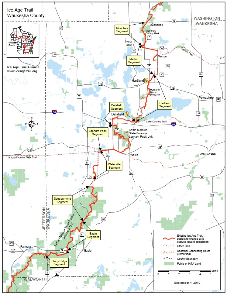
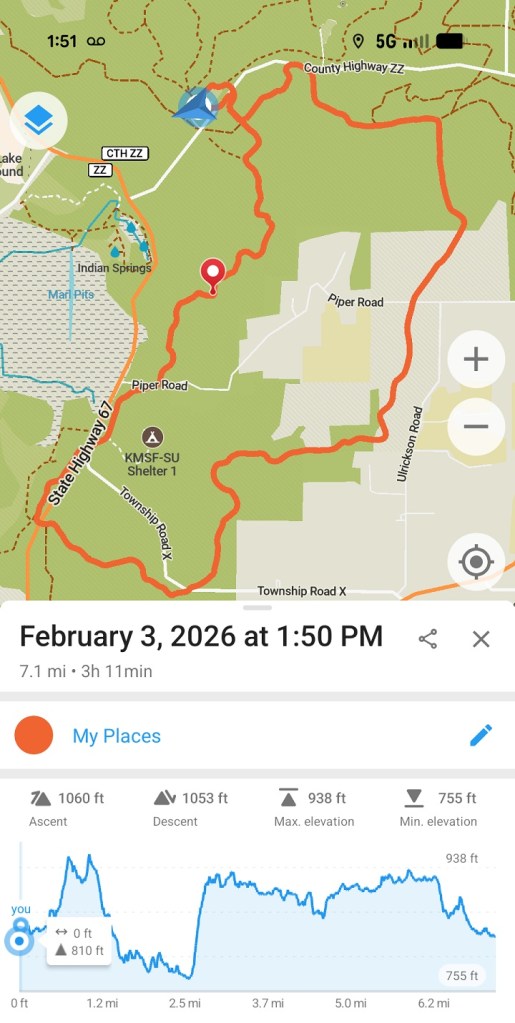
I started today’s hike from a parking lot on Highway ZZ, which appears to be the main access point to the maze of hiking, biking, and horse-riding trails in the surrounding area. The Ice Age Trail crosses Highway ZZ a few hundred feet north of the parking lot, so it was easy to join up with it there and walk 2.4 miles south, as far as the northern trailhead of the Eagle segment on Highway 67. From there, I crossed the highway to connect with the Moraine Ridge trail to make a 7.1 mile loop back to my van.
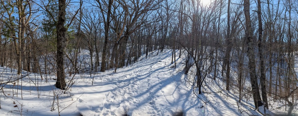
My dashboard thermometer told me it was 18 deg F when I parked. I was already dressed up in two layers of merino wool and a pair of thick wool socks. I added a fleece jacket and a nylon overcoat with hood, merino wool gloves and thick wool mittens. Even wearing all that, I could feel the deep cold all around me as I tramped through the shade of the pine forest that towered over the first couple miles of the trail. I moved at a pretty brisk pace those first two or three miles, trying to work up some body heat to keep me going.
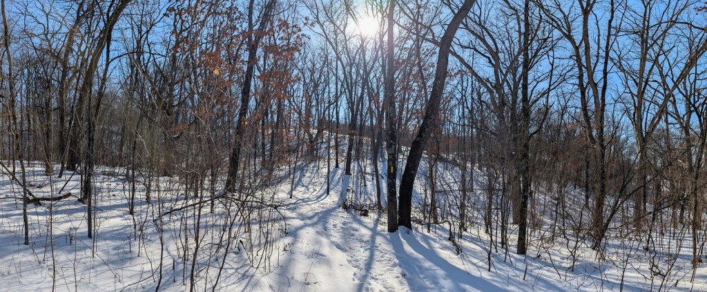
Although there were plenty of hills to climb along the way, none of them were very high. If these were moraines, they seemed like baby ones. I still can’t distinguish between moraines, eskers, drumlins, or kames by sight, but in my experience so far, moraines have been big, broad hills, much higher than eskers. Climbing to the top of one is usually all it takes to crank up my core temp. I don’t believe I felt warm, not really, until I got to the southern end of the Scuppernong Segment, in spite of the dozens of hills I went up and down.
The trail was hard-packed snow from one end to the other, frozen solid and easy to walk. When I was getting dressed in the parking lot, I briefly considered wearing snow shoes but decided to try walking at least five or ten minutes up the trail without. When I found I could easily hike along the packed snow in only my boots at a brisk pace, I kept on going.
I met just one other person along the trail in three hours of hiking, a woman walking two big, bouncy dogs. They were technically on leashes, as the trail rules require, but she wasn’t holding on to them, so when they saw me they ran away from her and bounded over to me as she tried to call them back. Untrained dogs ordinarily annoy the crap out of me but these big happy dogs clearly just wanted to play. I don’t try to play with strange dogs unless their person says or does something to let me know it’s okay, so I waited until they got bored with me and went back to their person.
At the point where the Scuppernong Segment ended and the Eagle Segment began, I turned east to cross Highway ZZ and climbed through the dead grass growing along the road. I wanted to connect with the Moraine Ridge Trail to loop back to the parking lot so I wouldn’t have to turn around and double back along the Ice Age Trail. Nothing against doubling back; I do that all the time, but when there’s an option to make a loop on a new trail to get back, I’ll take that instead.
The Moraine Ridge Trail appeared to be a bicycle trail in the summer and a snowmobile trail in the winter. I didn’t see either while I was on it today. The snowmobile tracks I saw looked like they were made last weekend and covered by the blowing snow that fell on Monday. From the road, I faced a long climb up a steep hill to the top of a ridge. By the time I reached the top, I was warm enough that I was forced to peel off my overcoat and stuff it into my backpack. This was more like the moraines I’ve climbed in the past.
This trail wasn’t as interesting as the Ice Age Trail. The IAT is usually routed along a visually appealing path. The Moraine Ridge Trail had a lot going for it in that regard, but it appeared to have been laid out for people to go real fast. That makes sense, particularly for snowmobilers, but it ends up being a visually boring trail traveling in almost straight lines.
The hike back to my car on this trail was longer than the hike down on the Ice Age Trail. It’s only 2.0 miles from the parking lot to the south end of the Scuppernong Segment, but according to the trail app on my phone I walked a total of 7.1 miles, so the walk back on the Moraine Ridge Trail was 5.1 miles. About two-thirds of it was through the woods, the other one-third across open fields.


Leave a comment