It was way too cold to go wandering through the woods today. I went for a hike anyway.
Temps this morning were between 15 and 20 degrees, according to the NOAA. The thermometer stuck to our front window read 12 degrees when I got out of bed, 14 degrees when I left the house at eleven. The dashboard thermometer in my minivan stubbornly reported it was 21 degrees all afternoon. I’ll go outside in that kind of cold to shovel the front walk, or to get the mail, but otherwise on that kind of day I’m good with staying inside where it’s comfy to read a book or nap, preferably both.
However! I stayed inside all day on Tuesday, working a jigsaw puzzle with My Darling B, and all day on Wednesday, when temps were in the teens and the wind was howling. (Wednesday was a curled-up-on-the-sofa day. I finished reading “Replaceable You” by Mary Roach, A+ can definitely recommend.) I was getting a little stir crazy. It was time to get outside again.
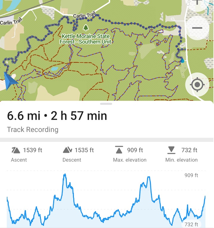
Lucky for me I have lots of thermal underwear, fleece pullovers, warm overcoats, and thick wool mittens and socks to protect me from twenty degree weather. I dressed up in many, many layers in anticipation of being out in the woods for hours this afternoon, a good choice because I can report that after two and a half hours of hiking I removed exactly none of those layers. I remained bundled up until almost the very end, removing my thick woolen mittens to have a tinkle while I was still about a quarter-mile from my car. At that point I figured I could make it wearing only the wool gloves I had on under the mittens. (I removed the gloves before I tinkled, then put them back on, which I mention only because I didn’t want anyone to think I pee with my gloves on. Yuck.)
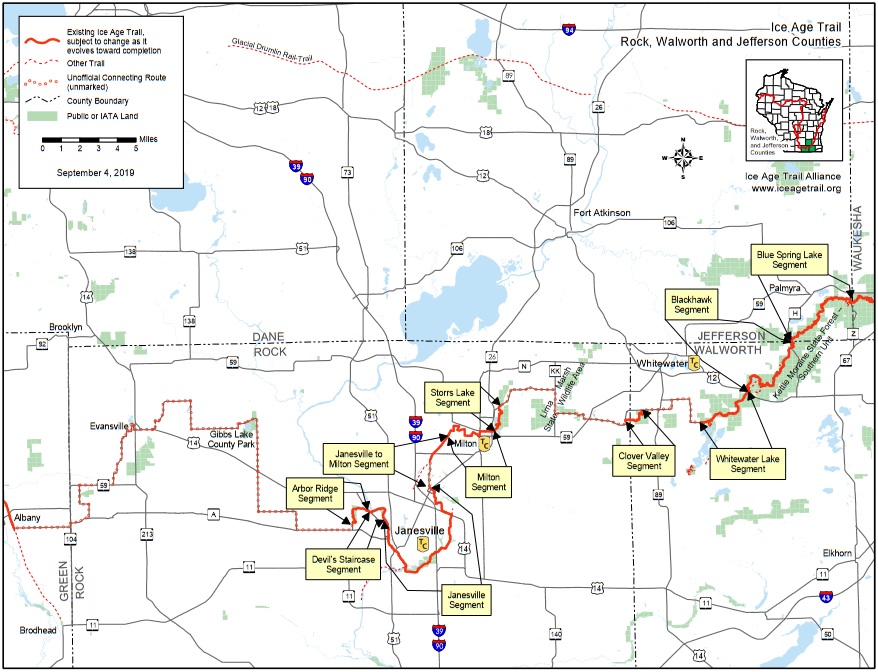
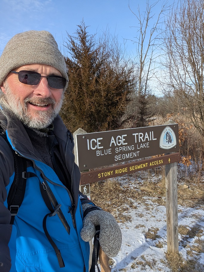
If I was going to all this trouble to go for a tramp through the woods, I wanted to walk a segment of the Ice Age Trail I’d never visited before. Last week, I hiked the Eagle Segment in Waukesha County, and while I was looking at the maps to plan that hike, they reminded me that I had walked half of the Blue Lake Segment back in March. I got as far as the Horserider’s Camp just south of Palmyra when I ran out of time and had to double back to my car, intending to finish the hike later that month. But, because I was hiking segments in a not-very-organized way back then, I didn’t get back to it. Until today.
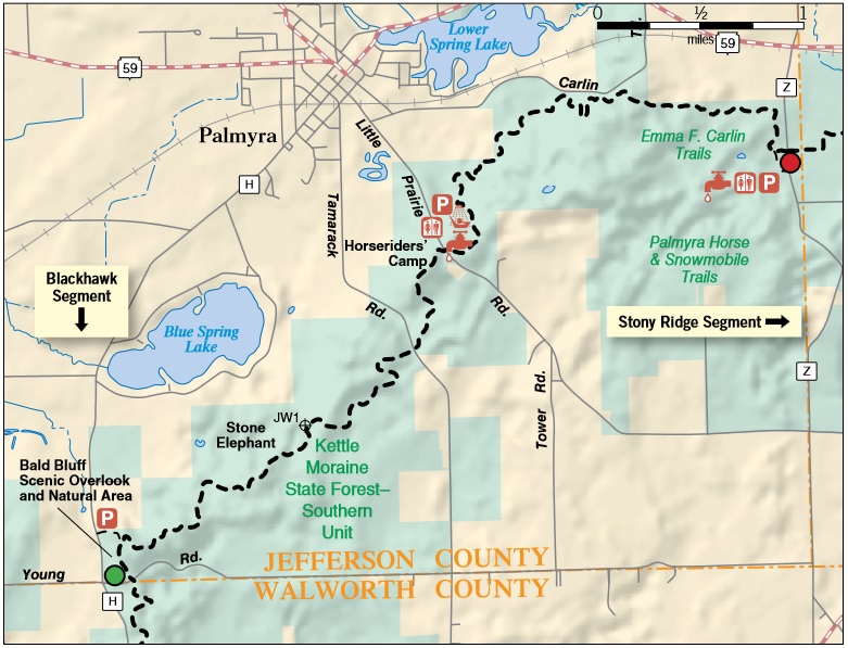
The Horesrider’s Camp is just what it sounds like: A campground for people riding horses. There are corrals and hitching posts between the camp sites, and bridal paths through the woods that surround the camp grounds. The bridal paths look very well maintained and they go on for miles through some very scenic wooded areas. I don’t ride horses but I might try it just to check this place out more thoroughly.
The camp grounds are open for camping from April through November, but there’s no gate to close off the camp grounds in the winter. I drove right in and parked in a camp site near the spot where the Ice Age Trail crossed through the camp grounds. I have no idea if that’s kosher but if anybody asked me, I would’ve pointed out the camp is run by the DNR and I have a state park vehicle sticker. I have a feeling nobody would question it, though, because several other people were parked in other camp sites. I expect they were hiking today, too.
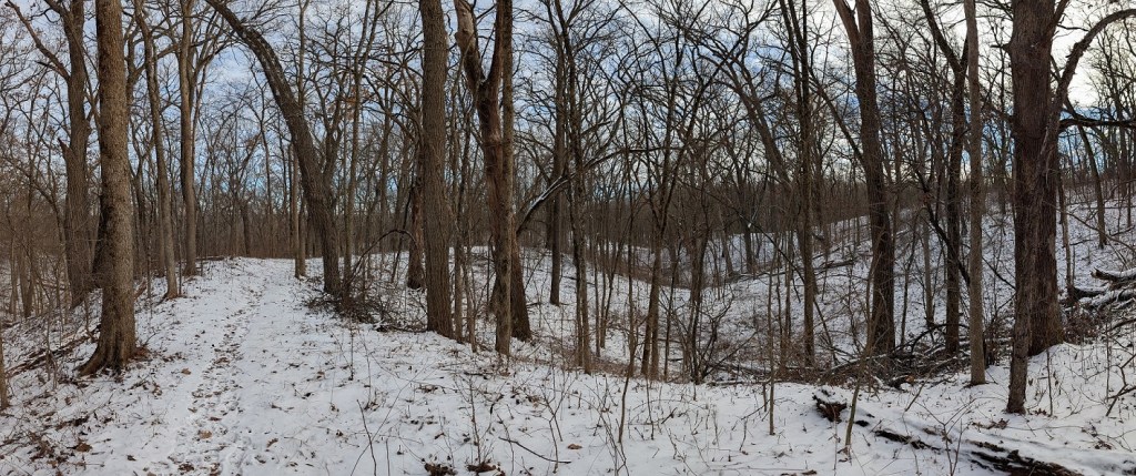
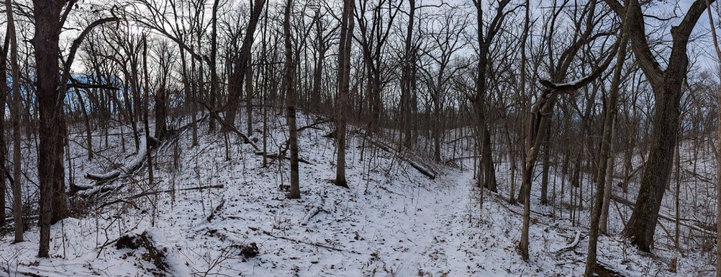
The first mile or so from the camp grounds was all in a densely-wooded area pockmarked by a dozen or so small, frozen ponds. The trees were all leafless but they were packed so closely together that they threw a respectable shadow over the snow-covered forest floor. I kept a pretty brisk pace to get my blood moving and to generate as much heat as I could. The ground was frozen solid and the snow cover was light; walking on it, even at a fast pace, was easy. I had a set of chains for my boots, in case the trail was slippery, but I never needed them. I also had my trekking poles for this walk but the only time I really needed them was for a few steep climbs later in the hike.
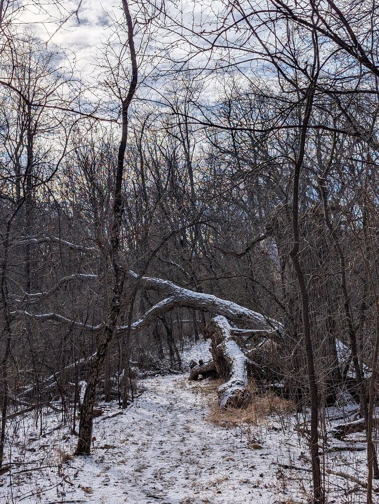
The trail went up and down quite a few hills in the second mile. The hills had the look of glacial formations. I can describe what an esker or a moraine is, but I can’t tell one from another by looking at them. These hills rose abruptly from the surrounding land, they were about fifty to seventy feel tall, and narrow. Following the trail, I had to climb to the top of the first hill, walk along the ridge on top, then dip down a bit before climbing to the top of the next hill. It was still wooded, but the trees weren’t as dense. I got more sunshine and a lot more cardio along this part of the trail; I even started to feel just a tiny bit warm, so I slowed down a bit to conserve energy.
Over the last mile the trail was much easier to walk. There were still a few hills to climb and descend but they were not nearly as much of a workout as in the middle third of today’s walk. I finished the segment off at a leisurely pace, took a little breather at the parking lot, and made sure I was thoroughly hydrated before doubling back to get to my car.
I have to mention that this is one of the noisier segments I’ve hiked. When I wasn’t within eyeshot of a county road or state highway, I was always very apparently within earshot, and today, for some reason, there was a lot of traffic on the roads. I have hiked other segments which were nearby roads — I would guess quite a lot of the IAT is near a road of one kind or another — but even so, I don’t believe I usually hear as much traffic noise as I did today. Not a criticism, just an observation. It very well might be that I’m editing my memory selectively. It’s something I’ll certainly pay closer attention to in the future.


Leave a comment