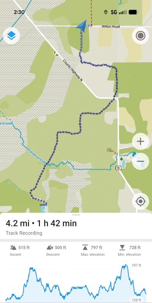
After spending all morning writing a blog post about yesterday’s hike along the Eagle Segment of the Ice Age Trail, I got the itch to drive back and re-visit it, maybe finish off the tail end of the trail I started yesterday, and walk a bit more of the trail on the southern end of the segment.
The trail crosses Wilton Road between County Road N and State Highway 67, a mile or so south of where I stopped yesterday. There’s no parking on any of the maps I looked at, but when I checked out photos of the road in Google maps, it looked like there was a hard gravel shoulder where the trail heads south from Wilton Road. I decided to go check it out.
And sure enough! There is plenty of room for two or maybe three cars to park completely off the road there so the occasional traffic along Wilton Road is not impeded.
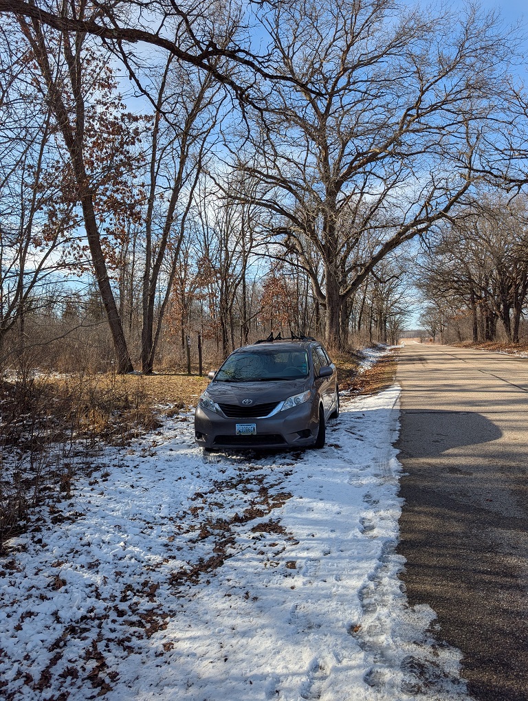
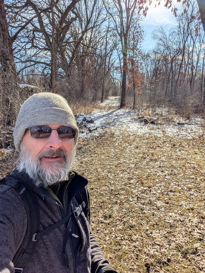
My plan, when I left the house this morning, was to park along Wilton Road and head north from there to complete the hike I started yesterday. After parking along the road, I walked to the trail, saw that it was a straight line that stretched as far as I could see through a field of dead prairie grass, and said to myself, nah. The tail to the south, through a wooded area, looked much more interesting.
The weather today was much better for hiking. Not warm, exactly, but sunny and not as windy as yesterday. Temps were in the forties all day. I layered up before I left home, starting with a polypro base, then pulling on a pair of nylon windbreaker pants and a smart wool pullover. When I got out of the car and started my hike, I topped off with a fleece jacket. I was plenty warm all day. By mid afternoon when I reached the southern end of the segment and turned around to head back to the van, it had warmed up enough that I had to ditch the fleece jacket.

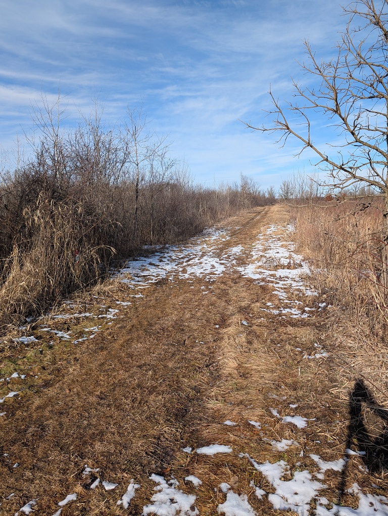
About one-quarter to one-third of the hike was through wooded areas where there was enough shade cast by the leafless trees to prevent the light snow cover on the ground from melting. The ground itself was a little mushy in places but most of it, even on the open fields where the sun shone directly on it, was frozen pretty solid. My boots got wet or muddy here and there, but quickly dried off.
Where I walked across open fields, or along the edges of open fields, I got warmer, then maybe a little too warm as the sun shone on me. Hence, the need to shed the jacket halfway through the hike.
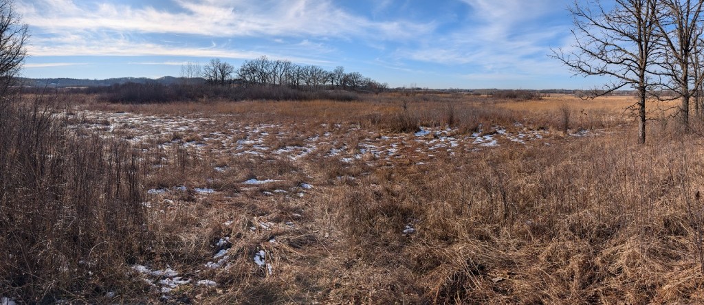
Among the highlights of today’s hike: There were some spectacular vistas of the Scuppernog Prairie State Natural Area from a few well-placed scenic viewpoints along the trail. The prairie stretched into the distance as far as I could see in some places. I’ll bet it’s even prettier in the spring and summer when the trees are in full leaf.
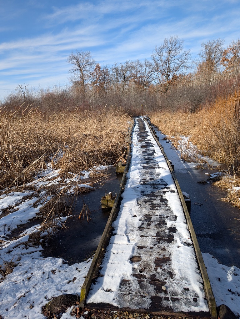
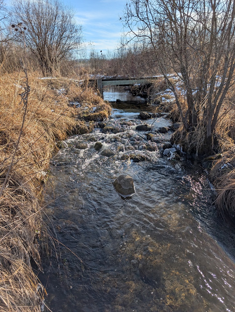
Another highlight was the bubbly creek I crossed near the end of the segment. I learned later from the map it was called Paradise Creek. I stopped along the shore by the bridge to get a few photos and to sit a listen to the water swirl around the boulders which may or may not have been used as stepping stones in the recent past. (I didn’t use them that way.)
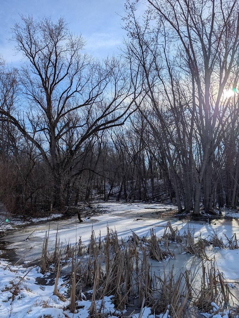
At the very end of the segment, there was a small pond, frozen over, next to the parking lot at the end of Stark Road, which had a very quiet, stately presence. I’m not sure if it was the way the pond was tucked into the base of a small hill, surrounded by trees, or the way the sun backlit the pond in the early afternoon. Maybe it was a little of both.
The trail continued down Start Road to the county highway, but I don’t normally walk the roads along the trail, so I turned back from the parking lot and headed back to Wilton Road. This was a very easy walk, I would even say it was more of a stroll than a hike. It felt much easier than yesterday’s walk on the northern half of the segment.


Leave a comment