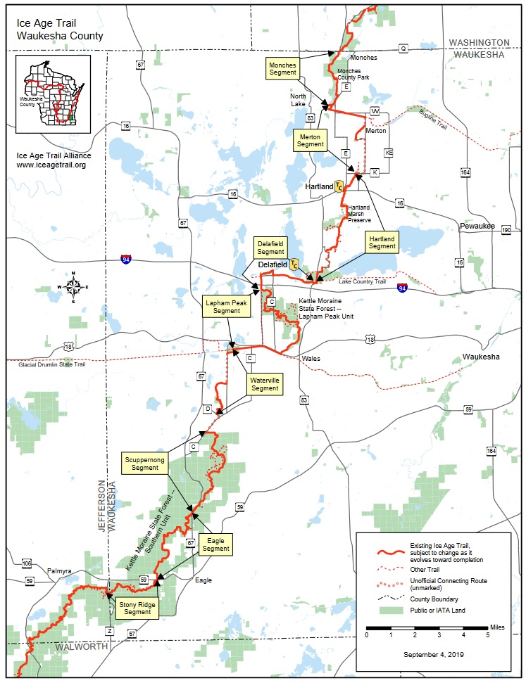
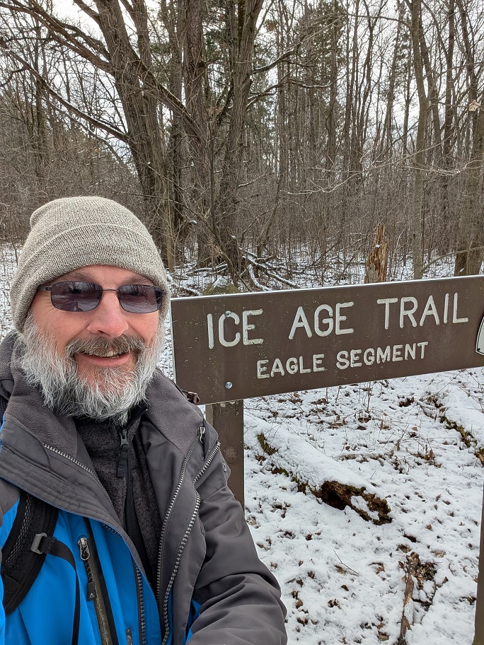
After morning chores, I drove about an hour east of the Madison area, turned south just before Delafield and drove past Scuppernog to get to the north trailhead of the Eagle Segment of the Ice Age Trail.
This was a spur-of-the-moment choice with no planning at all. I just wanted to go for a hike today and I wanted to see a stretch of trail I hadn’t been on before. When I get that feeling, I usually head for a stretch of the Ice Age Trail. Trouble is, I’ve hiked all of the IAT in Dane County, so now I have to travel outside the county to get to a segment I haven’t visited. That was bound to happen sooner rather than later.
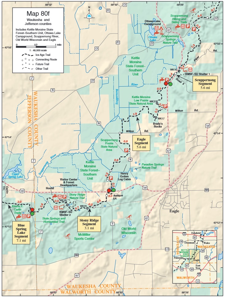
I’ve been out this way before but only as far as Palmyra, to hike part of the Blue Spring Lake Segment. I’ll walk the rest of that later; today I randomly picked Scuppernog off the map. Then, when I got to the trailhead, I decided the trail to the south looked more interesting than the trail to the north, so I walked the Eagle Segment instead of Scuppernog. The heart wants what it wants.
This would be an out-and-back walk, as most of my IAT hikes have been so far. I was solo, this was an unplanned hike so I didn’t arrange for a shuttle, and it was way too cold to bike back so I didn’t bother taking a bike with me. I figured I’d walk at least an hour, see how far that got me. I can usually walk between two and three miles in a hour, depending on the terrain, my stamina, and how often the scenery distracts me.
Although there were three cars in the parking lot, I had the trail entirely to myself on the outbound leg. I usually enjoy walking alone but this morning I could hear a lot of gunfire, so I spent more time thinking about keeping an eye peeled for hunters than I usually do, and wishing I was wearing a high-visibility hat and/or fluorescent yellow vest. Didn’t see any hunters and the gunfire was always very distant, probably more than a mile away.
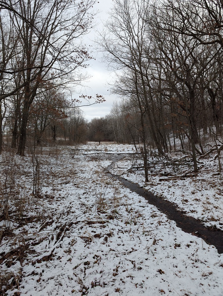
The whine of truck tires on Highway 67 quickly faded as I hiked into the woods until the only sounds were the crunch of my boots, the tap of my trekking poles, and the occasional pop of a shotgun in the distance. I didn’t hear any birdsong and even the squirrels stayed bundled up in whatever hollow they retreat into to stay warm in this kind of weather.
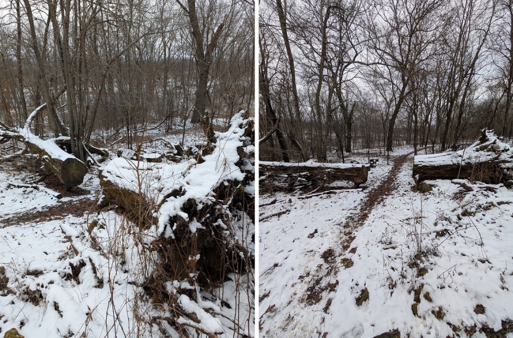
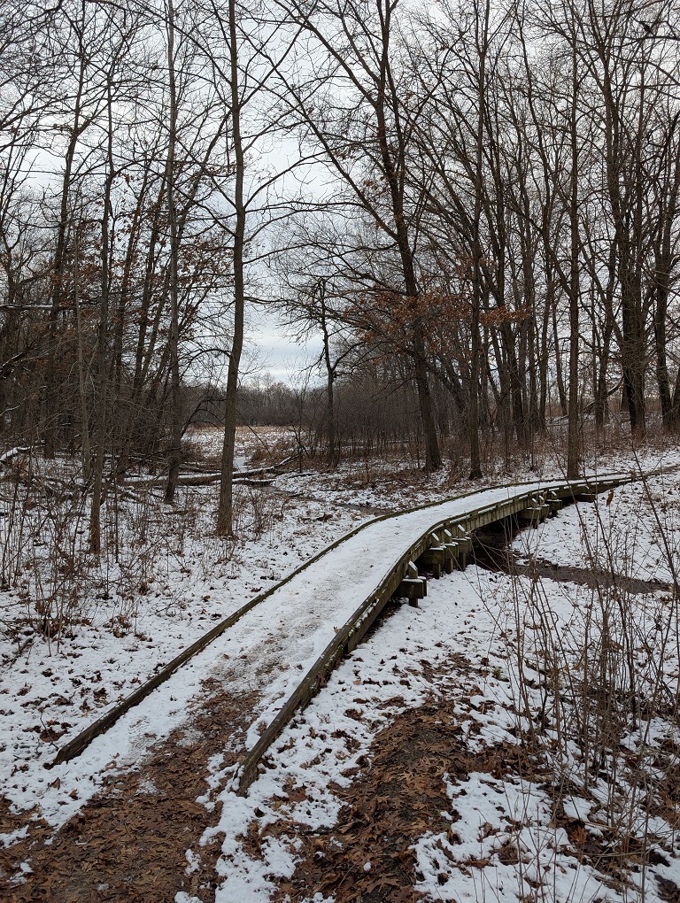
I had pulled a pair of crampons with chains and spikes over the soles of my boots at the trailhead because there was snow and ice in the parking lot, but there was no ice at all along the trail except on the short wooden bridges over the marshy sections. I could safely penguin-walk over those, so I pulled the crampons off after walking about fifteen minutes because snow kept balling up between the spikes and knocking it off was getting irritating.
After about an hour of walking I came out of a stand of trees to a stretch of trail that ran as far as I could see between two farm fields. I was out in the open. The wind was blowing in my face. The trail ahead didn’t look all that interesting. My trail app told me I had walked just over an hour and I was two miles from the trailhead, which was my goal for the day, so I picked that spot to turn around and head back. I could find this spot again when I started from Wilton Road on a future hike and headed north.
In contrast to the outbound leg, I crossed paths with half a dozen hikers on the way back to the parking lot: First, one lone hiker, then a couple hikers with a pack of four dogs, all of different breeds. Every one of the dogs was off-leash, but three of them walked at heel and the fourth came immediately when called. Their people put them in a sit off-trail so I could walk by. Dogs which are this well-trained are such a rarity around here that I was delighted to see them. I made sure to thank them as I passed by.
I passed three more solo hikers as I walked the trail back to the parking lot, one very quiet guy who barely opened his mouth to say hello, and a woman about my age who was in good spirits even though she was hoping for a little more sunshine than we got on today’s hike. The last guy I passed was just about to leave the parking lot, and didn’t say hello.


Leave a comment